Wildfires raging on more than a million acres in Kansas, Oklahoma and Texas leave at least six people dead
Author Vishay SinghPosted on Categories Discover Magazine
The wildfires show up clearly in these animations of satellite imagery
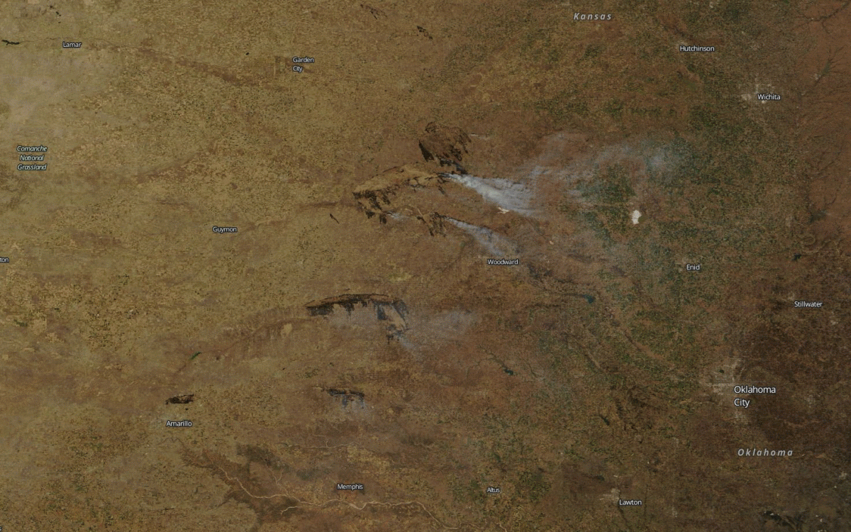
An animation of images from NASA’s Terra satellite shows fires burning across Kansas, Oklahoma and Texas. The first image in the sequence is in natural color; the second is in a false color scheme that highlights burned areas; and the third shows where the satellite detected active burning. (Images: NASA Worldview. Animation: Tom Yulsman)
Fierce winds, temperatures in the 80s, and low humidity, have whipped up deadly wildfires in the Southern Plains that so far have killed at least six people and prompted the evacuation of thousands.
The wildfires appear to have gotten started late Sunday into Monday — and then exploded today. A fire official in Kansas told the Wichita Eagle that the fire emergency there was “unprecedented.”
“We’ve had bad fires and we’ve had really bad fires but never multiples at once like this,” said Eric Ward, a fire specialist with the Kansas Forest Service, quoted by the newspaper.
I made the animation above using images acquired today by NASA’s Terra satellite. Smoke plumes and burn scars are easily visible.
Here’s what one of the fires in Kansas looked like from the air today:
Brandon McMillan sent us this incredible aerial photo taken earlier south of Ashland @KSNNews pic.twitter.com/mTFAaSq7U3
— Molly Brewer (@MollyBrewerKSN) March 7, 2017
All told, some 400,000 acres were burning across multiple Kansas counties today. Just to the south in Oklahoma, another 200,000 to 300,000 acres were burning, according to the Oklahoma Forestry Services department. And in Texas about 480,000 acres were ablaze, according to the Texas A&M Forest Service.
Put all that acreage together and you’ve got an area equivalent to six times the size of the City of New York.
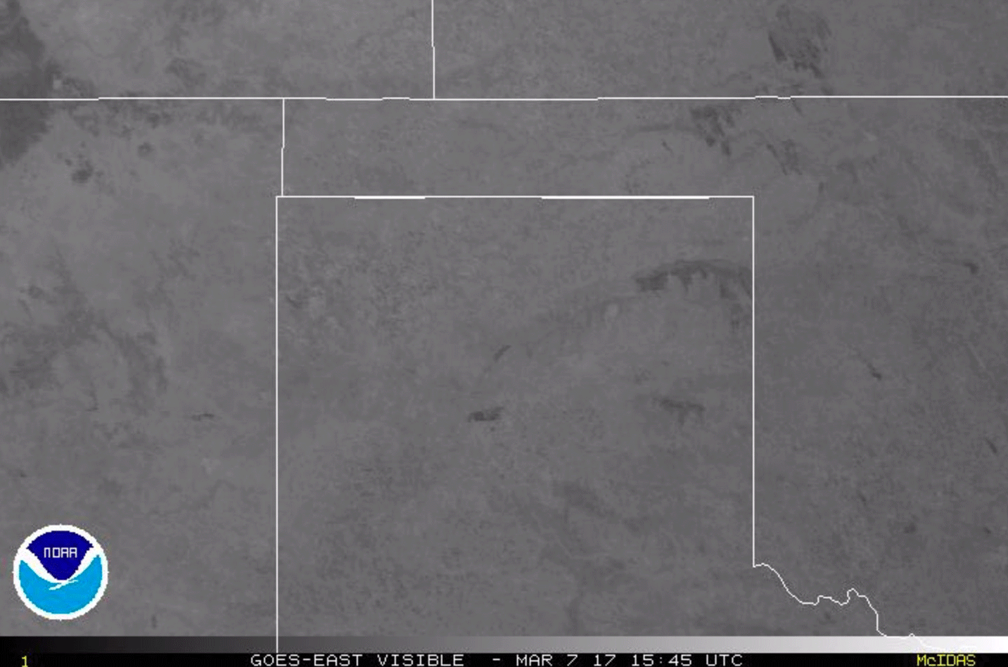
An animation of GOES-East weather satellite images acquired on March 7, 2017 reveals smoke plumes from multiple wildfires erupting in northern Texas, the panhandle of Oklahoma, and southern Kansas. (Images: NOAA. Animation: Tom Yulsman)
In this animation of GOES weather satellite images, you can see the same areas depicted in the imagery at the top of this post. The animation shows smoke plumes erupting from burning areas as high winds kick in.
“We’re not out of the woods, by any means,” Gov. Sam Brownback said Tuesday afternoon. “We’ve got to stay on top of this.”