Cloud porn: Watch as a swirl of clouds materializes into a beautiful, nearly perfect circle
Author Vishay SinghPosted on Categories Discover Magazine
A striking circle of clouds with a bullseye center is seen over Asia in a high-resolution satellite image, and an animation of multiple images
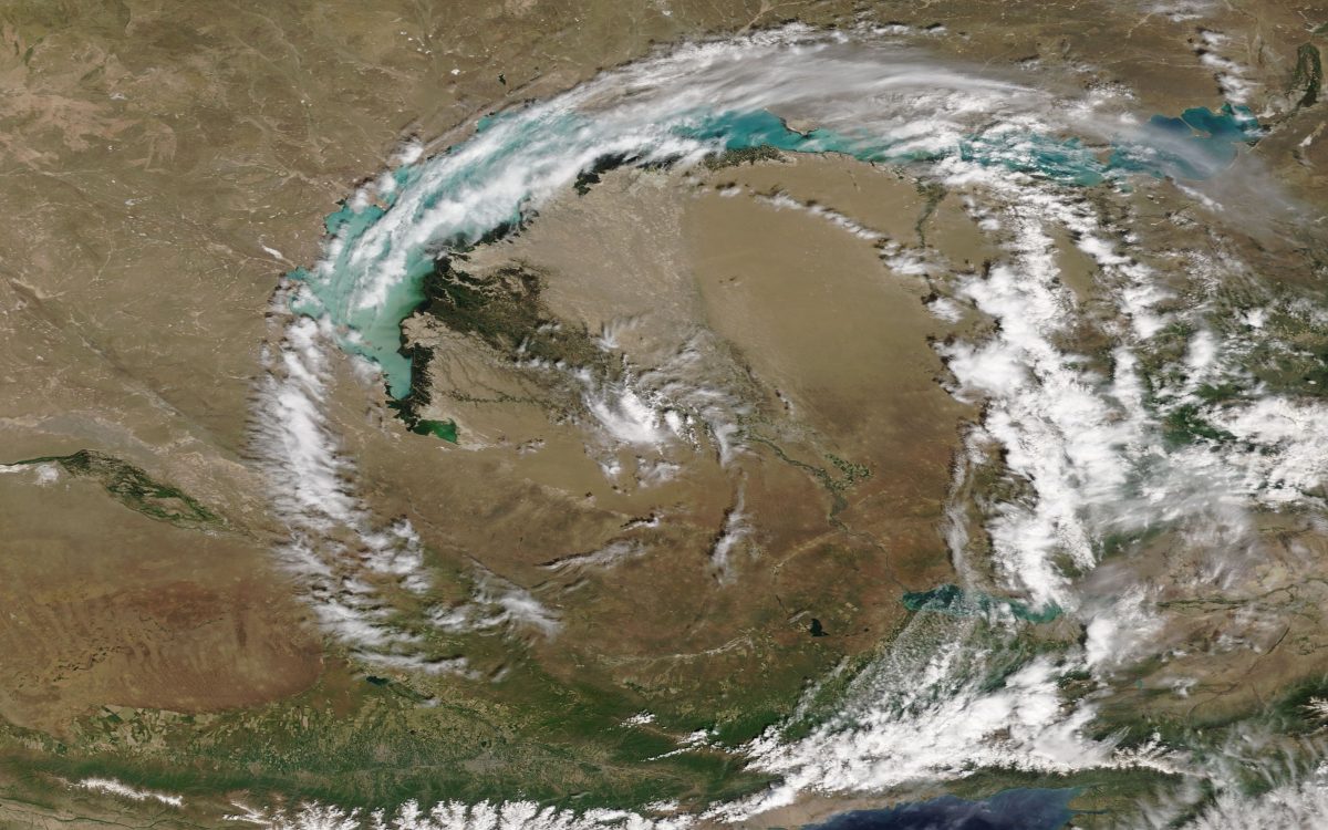
NASA’s Terra satellite captured this image of a circular swirl of clouds over Lake Balkhash in eastern Kazakhstan on May 22, 2018. (Source: NASA Worldview)
We’re accustomed to seeing satellite images of clouds organized in big swirly circles. They are, of course, called cyclones.
And, in fact, as I’m writing this post, one of these — Subtropical Depression Alberto — is looking quite impressive in all its swirly glory as it spins over Alabama.
But until I spotted the satellite image above in a story on NASA’s Earth Observatory site, I don’t believe I’ve ever seen clouds organize themselves into an almost perfect circle — let alone with a bullseye at the center.
The MODIS instrument on the space agency’s Terra satellite spotted the circular swirl of clouds as it drifted over Lake Balkhash in eastern Kazakhstan on May 22nd. According to NASA, the evidence suggests that “a few hours before Terra MODIS acquired the image, the circular feature was linked to an area of convection to the southwest over the western Tien Shan mountains.” Then…
Cyclonic wind flow drew the clouds into the circular pattern, which had a radius of roughly 200 kilometers (100 miles)—small enough that meteorologists would classify it as a mesoscale feature. In contrast, synoptic scale features have horizontal lengths greater than 1,000 kilometers, while microscale features have widths less than 1 kilometer.
After reading about this on the Earth Observatory site, I was curious to see if I could create an animation of satellite images to show the evolution of this feature. Here’s what I came up with:
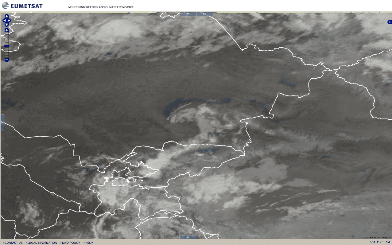
An animation of infrared satellite imagery shows the evolution of the circular cloud feature over Kazakstan on May 22, 2018. (Source: EUMETSAT)
The imagery in the animation comes from the Meteosat-8 satellite. It begins at 18:00 UTC on May 21 and finishes at 21:00 on May 22.
Switching back to the Terra satellite, here’s a view of the cloud circle in a much broader geographic context:
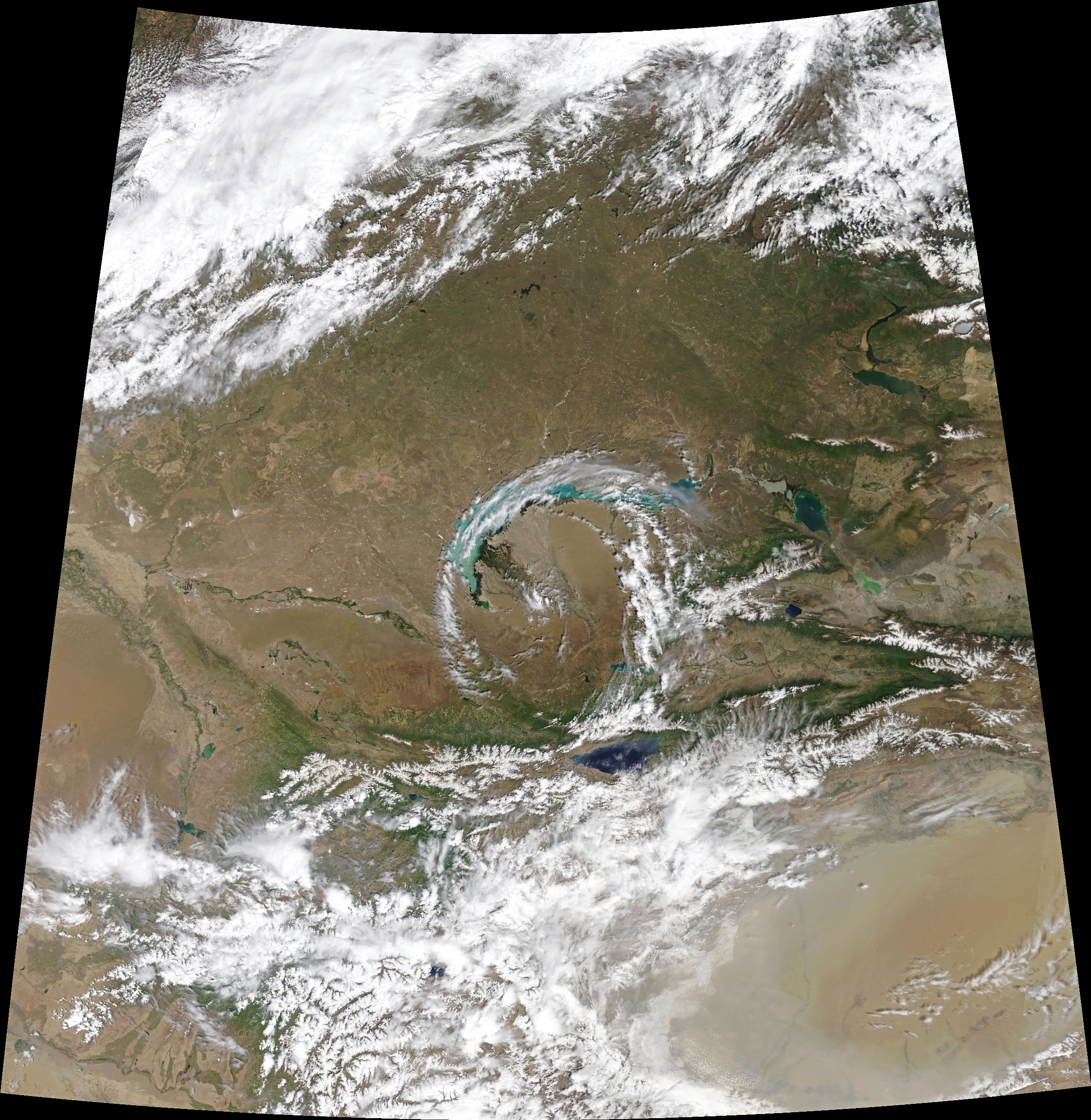
Source: NASA Earth Observatory
The northern part of the cloud circle is over Lake Balkhash. The big lake to its south is Issyk Kul, located in the northern Tian Shan mountains. The lake is itself noteworthy: In terms of water volume (but not geographic extent), it is one of the largest lakes in the world — with a maximum depth of 2,224 feet!
I’ll leave you with this animation of swirling Subtropical Depression Alberto — a far larger and longer-lasting feature:
Check out this incredible visible satellite loop of Subtropical Depression #Alberto gyrating over Alabama. #GOES16 pic.twitter.com/lrQ7Sb4nOj
— Wx Geek (@Wx_Geek) May 29, 2018