Views from space reveal the staggering extent of Harvey's flooding – now confirmed as a 1-in-1,000-year event
Posted on Categories Discover Magazine

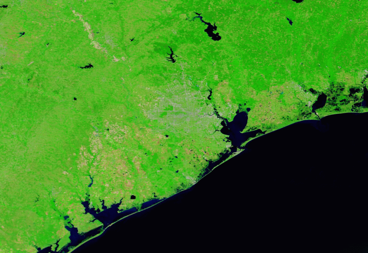
Satellite images centered on Houston taken on May 2, before Harvey, and Aug. 31, 2017, afterward. (Source: NASA Worldview)
As Harvey has lumbered to the northeast, the clouds have dissipated, finally giving satellites a clear view of what the 1,000-year flooding event in southeast Texas looks like.
The animation above tells the tale.
I created it using images acquired by NASA’s Terra satellite, the first on May 2nd, long before Harvey stormed ashore, and the second image just today. Look carefully at the center of the images and you can see the pattern of roads in the Houston area. (Click on the thumbnail at right for a labeled map that can help you get your geographic bearings.)
The false-color scheme emphasizes the presence of liquid water in deep blue tones. And check out just how much is covering a vast swath of southeast Texas.
It is, in fact, a 1-in-1,000 year flooding event, according to an analysis by Shane Hubbard, a researcher with the University of Wisconsin’s Space Science and Engineering Center, quoted in an excellent story by the Washington Post’s Jason Samenow today.
“This is something that hasn’t happened in our modern era of observations,” Samenow quotes Hubbard as saying.
Here’s what the same scene as above looks like in natural color (make sure to click on it to see it full-sized):

Before and after satellite images reveal the extent of flooding in southeast Texas. (Source: NASA Worldview)
Houston’s roadways are clearer here. But the flooding may be a little more difficult to discern. It is visible in muddy tones, which of course makes sense, since the water has collected huge amounts of sediments as it has run off the land.
Check out the change in color of the big bay on Houston’s southeastern edge. It goes from greenish to brown – and a lot of that turbid water is now flowing out into the Gulf of Mexico.
There are fears that floodwaters could be contaminated by toxic chemicals from Superfund sites in the Houston area. Much of that could find its way into the Gulf.
