Livestream: The Great American Eclipse
Select Category Select Tag Select Archive ...read more
Select Category Select Tag Select Archive ...read more

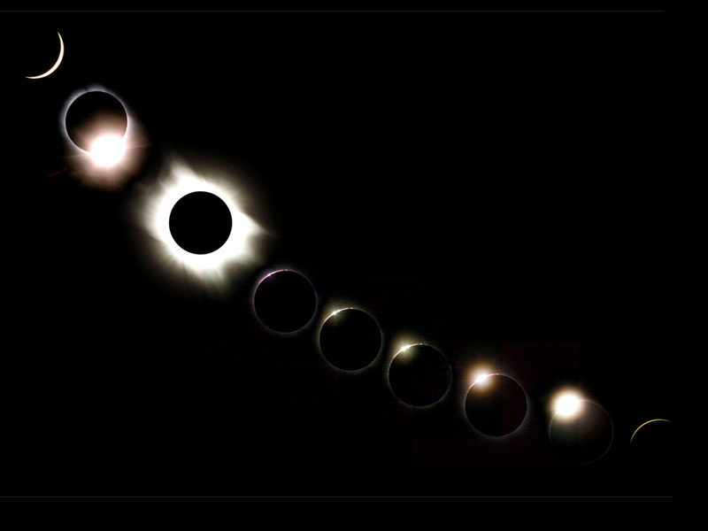
A total solar eclipse on March 9, 2016, as seen by NASA’s DSCOVR spacecraft. Millions of people across the United States will cast their gaze upward to watch tomorrow’s total solar eclipse as it passes across the breadth of the nation. But what would it look like if you could gaze down on it from a million miles away in space? For an answer, check out the animation above. It consists of 13 images acquired by the EPIC camera aboard NASA’s DSCOVR spacecraft ...read more
Select Category Select Tag Select Archive ...read more
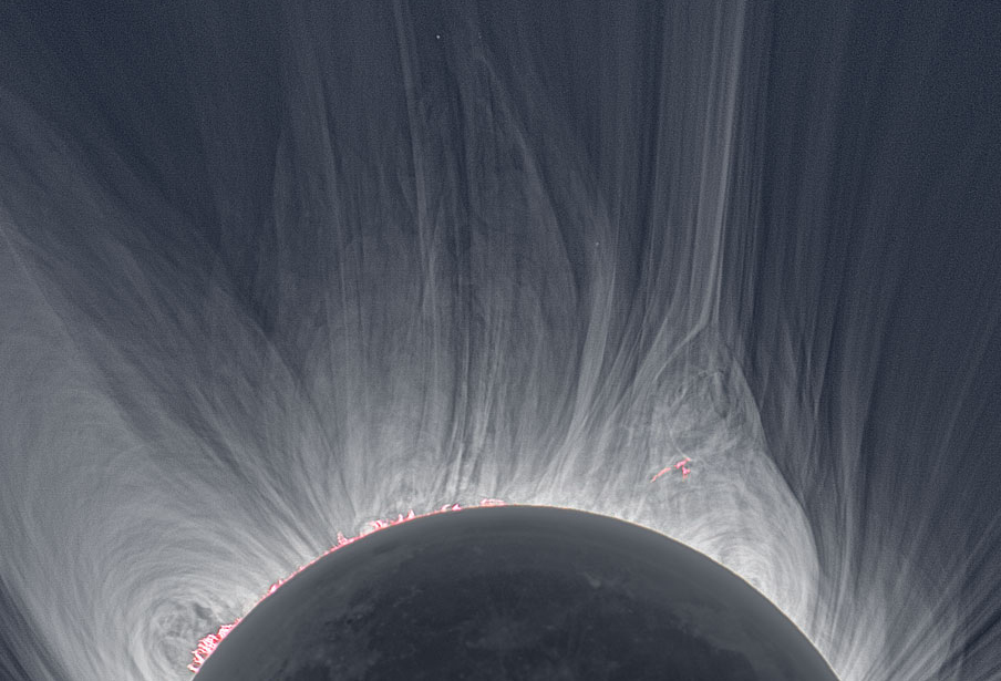
An image of the sun’s corona taken during a 2008 solar eclipse in Mongolia. (Credit: Miloslav Druckmüller (Brno U. of Tech.), Martin Dietzel, Peter Aniol, Vojtech Rušin) When the moon slides in front of the sun Monday, millions of viewers will catch a glimpse of the sun’s corona, which will appear as a hazy glow outlining the solid shadow in front of our star. Scientists will be watching closely as well, because eclipses are one of the few times they can easily gather d ...read more
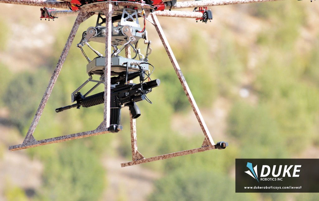
The TIKAD drone can carry marksman rifles, assault rifles and even grenade launchers. Credit: Duke Robotics In 2015, Israeli Special Forces likely made history by using a sniper rifle mounted on a commercial drone to take out a target. The robotic solution that achieved such pinpoint accuracy came from Duke Robotics, a startup founded by veterans of the Israel Defense Forces. That startup has since developed a multi-rotor sniper drone capable of accurately firing a wide arr ...read more