This NASA animation shows something one could mistake for blue blood pumping in an alien venous system
Author Vishay SinghPosted on Categories Discover Magazine
Alien it most certainly is not. But the word ‘venous’ is not far from the mark. So just what is this thing anyway?
When I first spotted this mesmerizing animation on Twitter, my mind really did wander to the metaphorical idea of blood flowing through some sort of alien venous system.
And actually, to the extent that a river can be the lifeblood of a region, you are looking at something akin to a venous system.
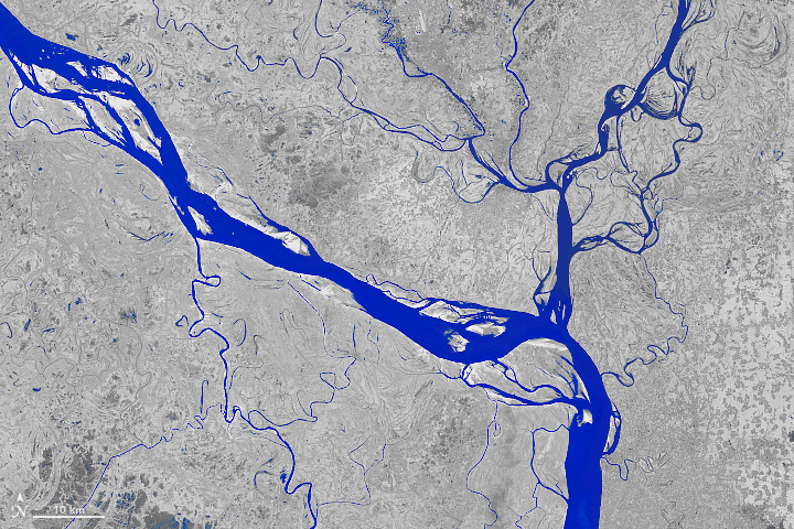
The time-lapse animation consists of 14 false-color satellite images of the Padma River, one of the major watercourses of Bangladesh. They were acquired by the Landsat 5 and 8 satellites between 1988 and 2018.
As described in a story at NASA’s Earth Observatory:
For decades, the Padma River has meandered, twisted, and weaved in different shapes through central Bangladesh. Each zigzag and turn tells a geologic story of the region, such as a large flooding event or the opening of a nearby dam.
The images that tell this story of meandering, twisting and weaving were acquired in a combination of shortwave infrared, near infrared, and visible light. And the goal of using them to create this false color view was to highlight differences between land and water.
Here is the same animation, but this time slower, and using natural color:
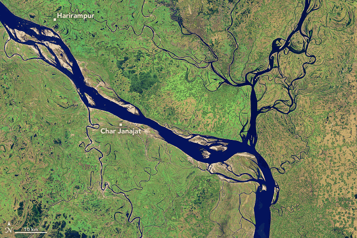
Images: NASA Earth Observatory. Animation: Tom Yulsman
The shoreline of the river in the animations is a relatively modest 75 miles long. Even so, thousands of people rely on the river for irrigation and transportation, according to NASA. Their lives are made challenging by erosion of the riverbank, and the resulting shifting of the shoreline, which is seen so vividly in the imagery.
From a second NASA story about the Padma:
Numerous farms, houses, and lives have been lost or displaced in recent decades because of riverbank erosion that can swallow large chunks of the shore. Every year, hundreds (sometimes thousands) of hectares of land erode and fall into the Padma River. Since 1967, more than 66,000 hectares (256 square miles) have been lost—roughly the area of Chicago.
Look in the upper left corner of the animation above. This the Padma’s upper reaches in the Harirampur region. According to NASA, this section:
. . . has experienced the most erosion and shows the most notable changes. The river has become wider at this section by eroding along both banks, although most activity occurred on the left bank. Using topographic, aerial, and satellite imagery, scientists found that the left bank shifted 12 kilometers towards the north from 1860 to 2009 and developed a meandering bend.
For more details on science of shifting rivers like the Padma, check out the NASA stories I’ve linked to. For geo-geeks (like me!), they offer a great primer in hydrogeomorphology.